


Maps of Canada, provinces and cities
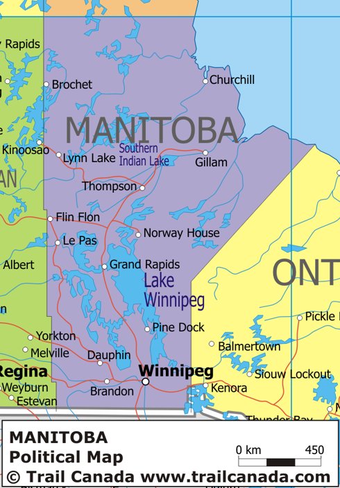
Political Map of Manitoba
This is a map of Manitoba showing the policial borders between Manitoba and the province of Ontario to the east, Saskatchewan to the west and Nunavut and Hudson Bay to the North. The United States of America borders to the south of the province.
![]() Click here for a physical map of Manitoba.
Click here for a physical map of Manitoba.
Recommended Map for Travel in Canada
 Canada Road Atlas
$15.00 (US Dollars)
![]()
$9.95 (Canadian)
![]()
£49.95 (UK)
![]()
Edition: Paperback
Publisher: Heiler, Peter Ltd (December, 2001)

Subscribe to the newsletter

- Read the newsletter and past issues
- Read articles about Canada and travelling